
TrailEasy6f100fb1…44c7
Waterfront Trail Rostock
Explore Rostock's maritime charm along the Warnow.
5 StopsEstimated Duration: 58 minutes
This 2.73 km route from Mühlendammschleuse to Stadthafen Rostock offers a close-up look at Rostock's maritime history. Start at the Mühlendammschleuse, a monument that symbolizes the connection between Oberwarnow and Unterwarnow. Continue to the Astronomical Clock in St. Mary's Church, a cultural highlight with its impressive 15th-century mechanism. Finally, arrive at the Stadthafen Rostock, where you can enjoy the vibrant atmosphere and proximity to the historic old town. The trail blends history, culture, and leisure, providing a diverse glimpse into the Hanseatic city.
Did you know? — Mühlendammschleuse
The conversion to a portage route was completed in 2020.
Listen
English
 English
Waterfront Trail Rostock — English
0:000:56
Trail Route
Route and stops
Walking routeConnector distances follow the accepted pedestrian network route. This is a route overview, not turn-by-turn navigation.
Live next-stop guide
Your location stays in this browser and is used only while the guide is on.
1
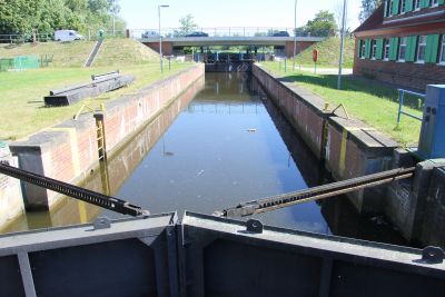
Mühlendammschleuse
Monument
995 mStop 1 to stop 2
2

Raumklammer
Bridge
484 mStop 2 to stop 3
3
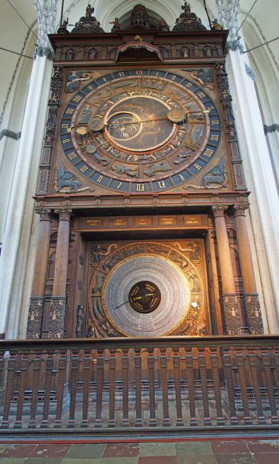
Astronomische Uhr
Culture & Entertainment
424 mStop 3 to stop 4
4
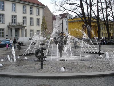
Brunnen der Lebensfreude
Fountain
830 mStop 4 to stop 5
Evidence and review:
- AI-generated
- Automatically approved by policy
- Not editorially reviewed
More trails in Rostock


Image credits
- Waterfront Trail Rostock (header image): © Hajotthu (CC BY-SA 3.0) · Wikimedia Commons
- Mühlendammschleuse: © Mühlendammschleuse (CC BY-SA 4.0) · Wikimedia Commons
- Raumklammer: © Darkone (CC BY-SA 2.5) · Wikimedia Commons
- Brunnen der Lebensfreude: © Schiwago (CC BY 2.5) · Wikimedia Commons
- Stadthafen Rostock: © Ch.Pagenkopf (CC BY 3.0) · Wikimedia Commons
- Heritage Sites in Rostock: © Ch. Pagenkopf (CC BY-SA 3.0) · Wikimedia Commons
- Rostock Through the Ages: © A.Savin (FAL) · Wikimedia Commons