MonumentHeritage Monument98c29feb…ce9a
TP Kemmlerberg
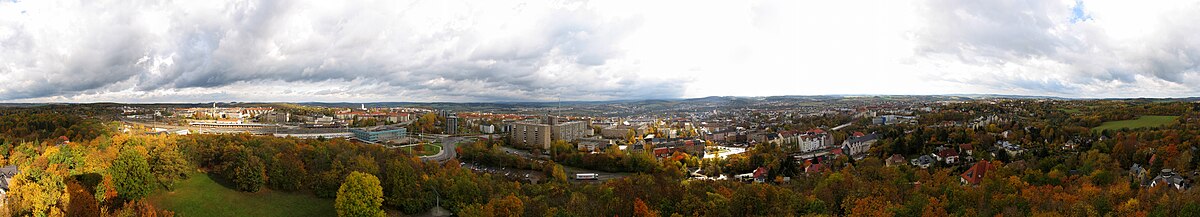
Discover Historic Surveying on Kemmlerberg
Counts toward these achievements:
Plauen: First Steps10 pts
Plauen: Explorer25 pts
Plauen: Insider50 pts
Explore the history of land surveying at this key site of the Royal Saxon triangulation network. Established in 1876, the monument represents engineering and precision. Visiting here connects you to the significance of geodesy in the 19th century.
Be the first to check in here
Did you know?
The triangulation pillar was erected in 1876.
Quick Facts
- Founded
- January 17, 1876
- Heritage Status
- Heritage Monument
Guided Story
Feel that gentle breeze? It carries stories from the past. Look up, and you'll see the proud pillar standing tall. Imagine this place bustling with engineers in the 19th century, using delicate instruments to chart the land. Just a short walk south, you'll find the Kemmler Tower. Picture those surveyors gazing out, using the views to map out Saxony. Every sightline, every calculation added a piece to the puzzle, making sense of the world around them.
Part of These Trails
Monuments of PlauenStop 2 of 9